Monday, July 24, 2006

Sand Dunes of the NItzan area of Israel


In Hof Ashkelon, between Ashkelon and Ashdod are the remains of some amazing sand dunes that used to stretch all along the Mediterranean coast. When Israel was created, the leaders of the state thought that the dunes had no special value, so cities were built on top of many of them. Today, there are still two protected dune areas, one north of Ashdod before Tel Aviv and the other between Ashdod and Ashkelon, which we visited. We were treated to an hour of Yair Farjun‘s time. He is the director of the Beit Sefer Sadeh, the field school of the Nitzanim sand dunes.


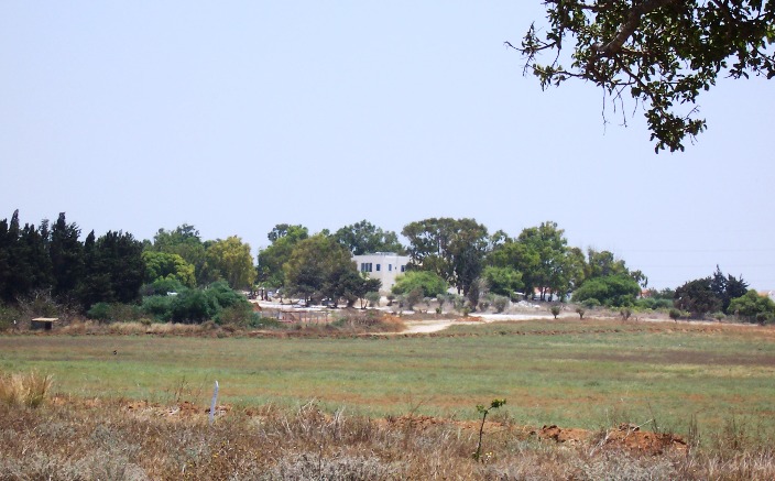
The field school--picture taken from the dunes


The Nitzanim Sand Nature Reserve is over 25,000 dunam (4 dunam equal an acre) The park is 8 kilometers long (almost 5 miles) and between 800 meters (1/2 mile) and 2.5 kilometers (1.5 miles) wide at the most. The area has a Sahara Desert ecology with a Mediterranean climate, a unique environment.

In 1948, 3% of the dunes was covered with plants. Now approximately 50% is covered and in 30 to 40 years in will be 95% covered unless something is done to halt the progress. Yair proceeded to explain how the dunes began and how this modern situation had come about.


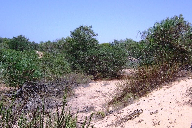
Dunes heavily covered by vegetation


The most prevalent theory was that sand was just along the coast for thousands of years. Around the year 600 or so, the easternmost branch of the Nile (called the Afilusit?) around a big city called Filusion somehow got filled with sand and dried up. As a result, a huge sand tsunami ensued that lasted for close to 100 years, blowing sand from that former branch of the Nile to the East and North. As a result, millions of cubic meters of sand fell on what is now Israel.

Recently, archeologists have become interested in the dunes of Nitzanim because they have evidence to show that Byzantine cities probably lie 6 or 7 meters under some of these dunes. When the sand storms hit in the 600s, the cities were eventually buried, according to this theory.

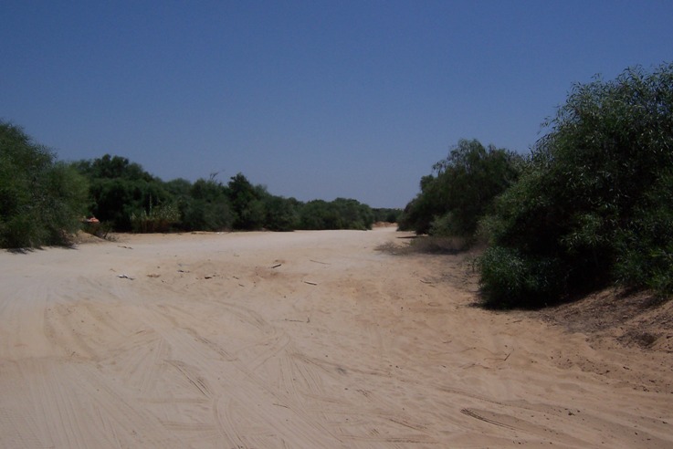
Before Israel’s independence, this area flowed with rolling sand dunes and looked very much like the Sahara. The area averages about 450 mm of rain a year (about 18”), and much of the wind occurs when it rains. The wind at the Nitzanim dunes, however, only may hit 80 kph (50 mph) 5 times a year. Usually the winds are around 20 to 30 kph (12 to 18 mph) which is not stong enough to cause the dunes to roll, especially when the winds occur with rain too. So the dunes would more likely be static, not rolling.


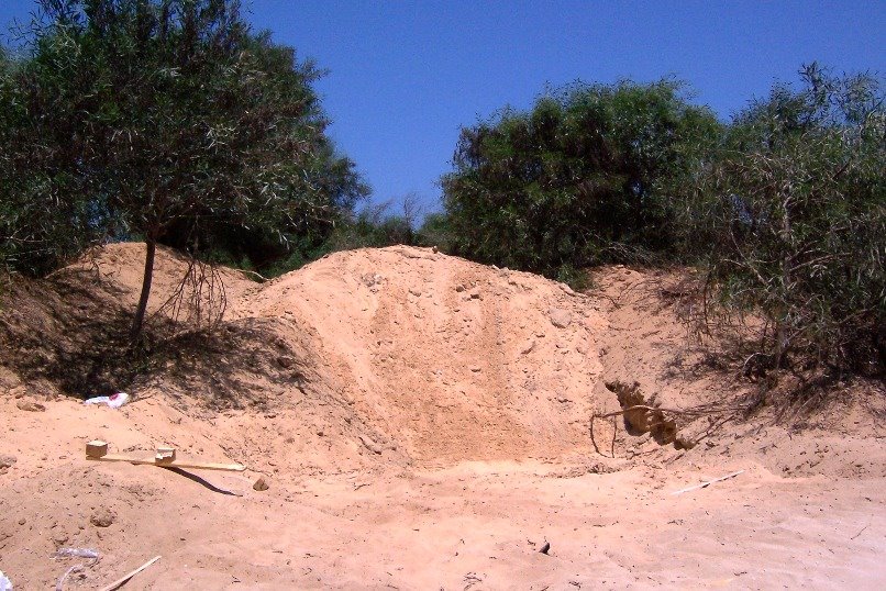
So why were they rolling before 1950? During that time, there were several dozen small Arab villages around the area including Majdal. Beduin from the Beersheva area frequented these dunes in winter and early spring. They came with sheep and goats and also camels who fed on the plants, especially those in the lower parts of the rolling dunes where water had gathered. As they walked over the hilly part, their hoofs broke the patina, the thin harder crust of sand. By doing so, the wind come move the sand. Since the animals ate the plants, the dunes had almost none and could roll more freely. If you look at arial photos taken during World War I and also from the 1920s, 1930s, and 1940s for this area, the dunes look just like the Sahara.

Then starting in 1949 to 1967, there was a steady increase in the plants covering these dunes.

However, in 1967 and 1968, the plants decreased somewhat and the percent covered by plants stayed somewhat the same until 1982.

From 1983 until now, there has again been a steady increase in the number of plants.

What caused all of these to come about? The basic answer is politics.

After the War of Independence, there was a huge demographic change in this part of Israel. Most of the Arabs in the villages surrounding the dunes left, so they no longer brought their animals to graze in the areas. Also, from 1949 until 1967, the Beduin of the Negev were under the control of the military police, and they were not allowed to move around so much, especially not to these dunes. So without the animals there to eat the plants that grew on the dunes nor to break the patina, the plants grew, and the dunes stayed static and did not roll.

After 1967, the Beduin had more freedom, and many came to these areas to graze their animals in winter. There were fewer animals than pre-1948 and not year round, so the area covered by plants did not decrease much. The Beduin did cut down some of the bigger trees, however, to use for firewood. In 1982, with the Peace with Egypt agreement, Israel gave up Sinai and had less land. The Defense Minister, later Agriculture Minister Arik Sharon, helped pass the “Land of Israel” law which evicted people from land they did not own. The Beduin were most affected, and few were allowed back on the Nitzanim dunes It took about 3 to 4 years to keep them from coming back. That is why the plants have covered so much of the dunes since then.

Only in the past 25 years have Israelis begun to realize how valuable these dunes are. Some plants only grow there and in no other place in the world. Small animals still live in the dunes and may not be able to live elsewhere. We saw evidence of this both in abundant animal feces of small animals, holes of small animals, and foot and tail prints in the sand.
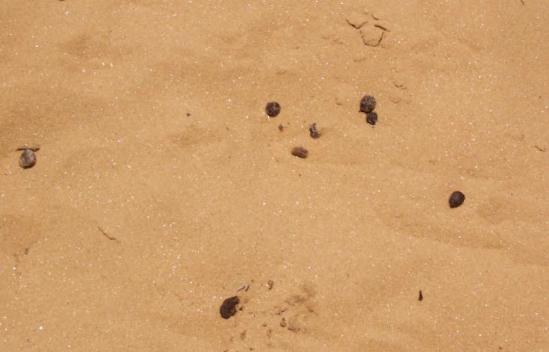
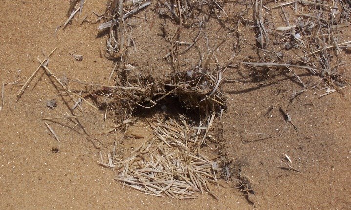
Animal Feces

Animal holes


Land Snails on plants in the dune areas


If these dunes disappear, there could be a huge ecological impact, soresearchers in many fields have shared knowledge to work to protect these dunes.

What is the future? Yair is excited about plans for the fall to bring Beduin back to the area. A special program is being set up with plans to pay a few Beduin to resettle in the area and work with scientists and graduate students to help reclaim the dunes. Their major weapon will be camels. They hope to bring in 40 or 50 camels for this area. (Ten to 20 would not be enough for 25,000 dunam of land, and 100 would be too many according to researchers.) Why camels? Because they eat everything. While goats eat the smaller plants, camels eat anything within their reach. The Beduin will also cut down some of the bigger trees too for firewood.
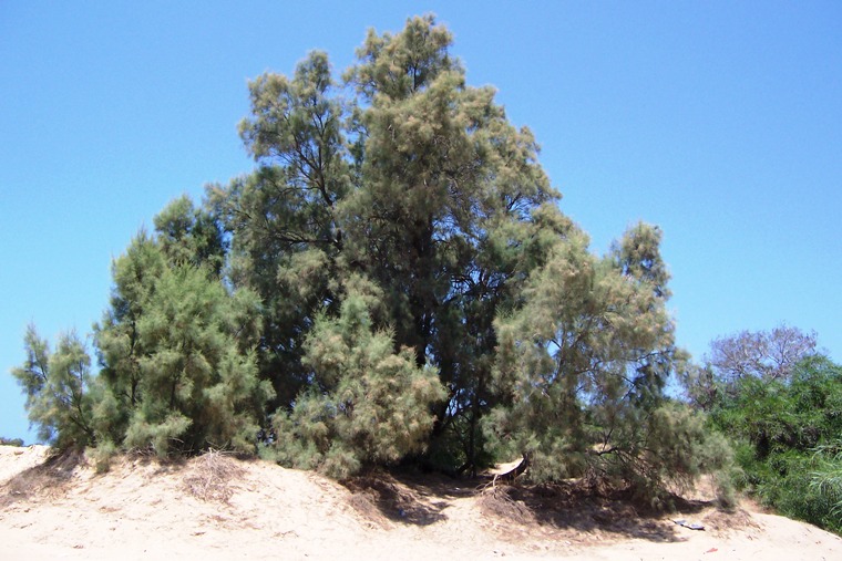
A large tree in the dune area nowadays


Camels also are sturdier animals and need to drink a lot less often that goats. Also, the camels have bigger hoofs and can break down the patina sand crust at a faster rate than smaller animals.
Can you just imagine these Israeli camels settling in to the Nitzan area?


Howard asked if the jeeps and dune buggies that sometimes go on these dunes help or hurt the dunes. Yair said that ten researchers have been checking into that. He said that the wheels of the vehicles have helped to break up the patina, but that they are not the answer. Israel has a renewed need for camels here.


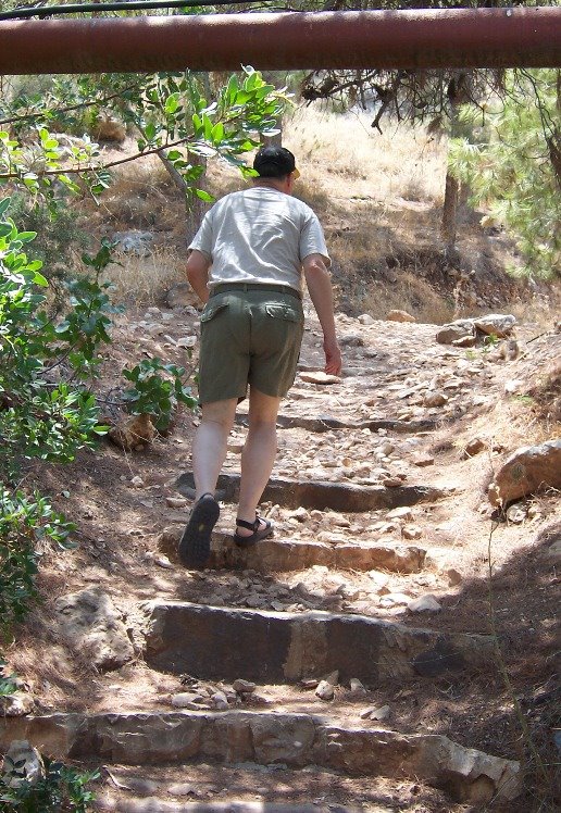
After talking with Yair, Howard and I drove closer to the dunes and then hiked in them for over an hour.

For more information on the Society for the Protection of Nature in Israel, please check out their American Friends website at: http://www.aspni.org/

Wednesday, July 19, 2006

July 15: On and Around the Gilboa Hills

Saturday, July 15, 2006 Tiyul with Pinchas south and West of Bet Shean

On Saturday, Howard and I were treated to another tour with our friend, Pinchas Nahmani. Because of the situation to the north, including Teveria being hit with katyusha rockets today, we headed south. First we drove through the Parvanot Community area south of Bet Shean. These settlements were mostly started after the War of Independence and were on the border for many years. Sde Eliyahu and surrounding areas stared in 1936 to 1939 and the rest after 1948. Most were settled by immigrant Kurds who were into commerce than farming, but after they came to Israel, they managed to do both. It is a religious area, and Pinchas told us that they have an eruv that stretches from south of Bet Shean down through the settlements, making it easier for area residents to walk back and forth between the communities on Shabbat.

The area includes Kibbutz Sde Eliyahu, Moshav Rahov, and Tel Te-omim (which is newer and was settled by children of area residents who returned to the area after studying or when they needed a new space). An agronomist on Sde Eliyahu has been doing a lot of research in his own lab and has got a start-of-the-art organic vegetable farm. Growing organic vegetables is the “hi tech” of farming, and Israel is working hard to develop it. Menahemia, where Pinchas and Dalia live, also has started growing organic grapes and has some covered with nylon to encourage them to ripen earlier. They are getting known as the “grapes settlement.”

We needed to make a bathroom stop, but there was no public place to stop as this is a religious area and all places were closed for Shabbat. So the call of nature was answered when we were out of the communities and started going toward the SE part of the Gilboa Hills/Mountains. As we drove up, we had a nice view of the Parvanot communities and the hot houses they have. We also saw a reservoir above them, which holds water and is also a good place for people to visit and picnic.


As we climbed higher we passed a limestone quarry on the right, belonging to Kibbutz Beit Alfa.
The open jagged hole of the quarry is not visible from the valley below because the workers purposely left a wall on that side so the ugliness could not be seen from below.


The far edge of the picture is where the wall is that hides the quarry from below.

Our goal was the top of the Malkishua hill. At one time, people tried to maintain a small town on the top of Malkishua. It is a beautiful area with fantastic weather—not too hot in summer with lovely breezes and not too cold in summer as it is not high enough to get snow.

On the way up, we stopped at an overlook created in memory of a 16-year-old girl named Aliza who was killed by terrorists as she was returning to her home in Meirav, a small town just below Malkishua.

This memorial has white broken-up limestone on the ground as well as small very lightweight black stones of tuff (volcanic stones mined by Kibbutz Merom Golan where I used to live) which line the central pathway.

You can see our rental car, a Hyundai Getz, in the background. This picture was taken from the area where the memorial stone for Aliza is, looking backward.
Here is a closeup of the volcanic lightweight tuff next to the limestone.... Those are Pinchas' feet!

Young plants and a sign memorializing Aliza also mark the spot.

From there, we can see an Arab village (Kfar Jalbun, I think) less than a mile away just below us in the West Bank as well as the border electronic fence and dirt path carefully monitored by the
army.
Taken with telephoto lens.

(Taken without telephoto lense.) You can see the army path on the right. A patrol vehicle drove by, inspecting, as we were at the overlook. As you can see, the boarder to the West Bank and the village are very close.

Until a few years ago, the border was not so carefully delineated but out of need, this has become the reality. Just to the east is a forest planted by the Jewish National Fund. We could see another Arab village in the distance and another Israeli one a bit more to the East on the Gilboa hills.

The town Malkishua on top of Har Malkishua was not a success, but not a drug treatment center flourishes on the site. As we drove up, we passed a cattle grazing area. When cattle eat the dry grass, they reduce the risk of fire in the dry season. The gates to the center were closed, so we drove around until we got to a secure area and had to make a U-turn. We did see organic gardens up here too, a picnic area for visitors, planted whose roots were covered by torn up cardboard which helps keep the water from irrigation (and rain in winter) near the plants.
Organic grape vineyards with cardboard over the roots.

As we drove by, we saw groups of people walking around, working, and sitting together under a covered area. The drug treatment center did have an electronic fence around it and a gate (closed when we drove by) as it is very close to a West Bank town and need to protect the residents. As we drove down from Malkishua and passed Meirav, the back of the “welcome to Meirav” sign had a “good-bye” with the travelers’ prayer on it. We also saw some wide swatches of open area, and Pinchas said that these were fire lines that also coincided with divisions among agricultural fields.
As we drove by, we saw a modern dairy farm and cattle area. Below are some of the modern dairy farms with Malkishua on the hill in the distance center left.
Pinchas said that in the past 20 years, the environmentalists have developed a strong voice in the country. One thing that really concerned them was the waste of water in dairy farms and cattle raising. Dairy farms were asked to put in new systems that recycled water that they used, but most farmers complained and said that they could not afford to do so. As a result, the government changed its approach and said that it would give incentives (monetary grants) to those putting in new systems like we got for buying our Toyota Prius hybrid car. Along the way, we saw a number of these new cattle sheds.

Pinchas said that last year an Israeli company built such a dairy farm in China. China was interested in the system and invited the company to explain things. The company built the first one at cost, with hopes that there will be such an interest that the rest it can build and make a profit.

We stopped at a few more viewpoints/park-lets. The first was on the Avinadav ridge.


Of course I had to stop and take a picture of the signs because of Avi and Nadav’s names (my two sons)! The trees there were also from the Jewish National Fund. While the JNF used to plant many kinds of trees, they have started to focus more on fruit trees so visitors can enjoy the trees and the fruit they produce also. At the Avinadav stop, we saw figs, olive, and carob trees as well as lavender bushes as well as other spices.


I LOVE the fruit of the carob tree. (Hebrew = Heiruv) It is a bit early for it to be in season, but we did find one tree whose fruit was close to ripening. When the carob fruit is ripe, it actually is dried out….is no longer green on the outside or inside on the long wide beanlike fruit. One chews it carefullyas it is a bit woody to not bit into the seeds and hurt a tooth.


A half mile farther down the road and on the opposite side was another overview. We got out and walked up the hill. Along the pathway were stones with poetry about the Gilboa hills written on them. Here is an example of one.


At the top we saw that this place was built in memory of a father and son.


The father, Dubi Shamir, was born in February 1947 and died in 1977 while in the military. The son Eiran was born in 1974 and died 20 years after the father, also in defense of the country. It was poignant and sad…and the reality in this country, unfortunately. The view from here was spectacular as we could see all around.


We drove down the middle of the Gilboa range, down to Kibbutz Heftzi-ba, which is so close to Kibbutz Bet Alfa that it is hard to see where one ends and the other begins. A Japanese organization whose members support Israel built a lovely Japanese garden on the edge of the Kibbutz.


Here are Howard and Pinchas at the entrance to the gardens.


Here is a general overview of part of the gardens. It is unusual to see so much grass in parts of Israel because of the cost of irrigating it.


The group also has a prayer room built into a cave at the sight


and a house called Beit Mokoya or Mokoya House.
Real bamboo grows to the right of the entrance to Beit Makoya and several fake bamboo fences are close by too.


The park in dedicated to a professor from Japan.

In addition to statues, bushes trimmed in the style of a Japanese garden, and grass, there is also a fish pond with many different colored goldfish. There is a kibbutz in the Upper Galilee not far from Kiryat Shmona which now raises such fish for export to Japan. Right now demand exceeds supply.


Inside the pond are several tubes when the fish often lay their eggs.


There is also another small pond with water dripping down the walls into the pond.

This picture does not really do it justice...but there are several small sprinklers near the top...it is delightful to watch.

Members of the group have lived on the kibbutz for years and maintain this garden, an unusual site for Israel. There were no signs pointing to this garden, so unless one knows that it exists here, no one would know to come and visit. There is a channel going through the edge of the garden for water from the Gilboa to go when heavy rains fall.


There are also two paths up from the garden to the Gilboa Hills, and 4-wheel drive vehicles can go up the rocky paths too.

We might try climbing it on another trip, when we have more water and it isn't as hot...thought it was probably just in the high 80s that day.

We skipped going to a local non-touristy springs for swimming as Dalia was awaiting Shabbat lunch for us. She had 3 extra visitors--a co-worker from Teveria, Valerie’s mother-in-law, and Valerie’s 5-month-old son David. While we were gone, katyushas had landed in Teveria, a block from Valerie’s home--she actually saw it hit and she looked out of the window when she head the “boom.” Dalia called and invited Valerie to come to stay with them, as they were more to the south in a rural area. Valerie was happy to come. A few hours after she did come, more katyushas hit Tiberius, a block or two on the other side of her home!

As we headed back home, we noticed that a lot of cars were heading south. Many Israelis had gone to the beaches on the Kinneret (Galilee) for the weekend. With the first terrorist attack, the beaches were closed, so they headed home. Also, some residents headed south to stay with friends or relatives in the center of the country. It was the 3rd day of the war in the North.

Saturday, July 08, 2006

"Old" Beersheva

On Friday, July 7th, Howard and I met up with our friends Haim and Shuna at Kibbutz Shoval and went with them on a four-hour trip around Beersheva, the "capital" of the Negev. Haim loves to share information on the history of Israel, and so he is always a wonderful guide.

Beersheva is now a thriving city of over 180,000 residents and has a large hospital, a big university, lots of modern shopping, and businesses. It is truly the capital of the Negev. It also has more grand master chess players per capital than almost any city in the world, but that is another story! (The Biblical Beersheva was several miles east of the current one. It was a smaller town with a well and mainly was a military encampment. We visited "tel" Beersheva last summer with Haim.)

We drove from Kibbutz Shoval to Beersheva along the old road from Gaza to Beersheva. It was not much more than a dirt path until the Turks built an extension of the railroad to go from Gaza to the new town of Beersheva in the 1880s. (The British finally paved the road in the 1920s or later.) The Turks were the driving force in establishing modern Beersheva as a strategic area for themselves. It occurred at about the same time as the first or second aliya, so a few Jewish families were there from the beginning.

Before we entered the north end of town, we passed the old airport that first the Turks and soon after the British used. It is called S'deh Teiman. We could still see semi-buried earth-covered shelters (with some concrete reinforcement) under which a Spitfire could be covered. During World War I, the German and Turks were alies. Teiman was a German airfield until Allenby and the British conquered the area.

As we entered town, on our right we saw what was left of the train station complex that the Turks built.


You can see how this one building now stands among many recently built high-rise condos. The city is planning to restore the RR station and turn it into a museum. This train station area was the hub of a huge transportation system during World War I. There were LOTS of freight cars, etc and was definitely a target of British bombing raids.


Haim told us that that area was huge, that there were trains coming and going with supplies and soldiers, especially during World War I. Jews, often new immigrants, were brought in from Tel Aviv to work on the train arena. One group was housed in a stationary box car. During World War I, there was a black out. However, it seems that the Jews in the box car, didn't follow the rules of the black out--they pushed the limits a bit like many Israelis do today. So one night when British planes flew overhead, the pilot and navigator saw a light where the train station was supposed to be, so they bombed it. Unfortunately, 8 Jews in the boxcar were killed. To add to it, the British pilot of the plane was a Jew and he had no idea that he was NOT bombing Turkish soldiers. (See a photo below for the grave of those 8 men.)

Haim drove about three or four blocks from the train station until he found the base of the huge water tower that used to supply the trains with water after they arrived at the station. The distance to it gave us an idea of how big this train station really was.

As you can see, the base of the water town now exists among a kiddie play yard and many apartment buildings. In some ways it is a shame that this area has not been better preserved, though Haim says that there are plans to develop it better.

Just to the South of the remaining train station building, is a memorial to the Turkish soldiers that defended Beersheva against the British in World War I. It was erected by the city of Beersheva and the Turkish government. You can see Haim in the picture below. Just behind the memorial are the flags of Turkey and Israel.


A closer look at the memorial

At the bottom of the memorial is the writing to the left which is also in Turkish on another part. It says, "This monument is dedicated to the honorable Turkish army soldiers fallen at the Beersheva front for the sake of their country."

Lower on the memorial is the writing to the left, in Turkish and English: "Constructed on 20th October 2002 by the Republic of Turkey and Be'ersheva municipality in memory of 238 honorable Turkish army soldiers who lost their lives while service the Turkish state at the Be'er Sheva front between 1914 - 1918. It was interesting to me that the writing was in Turkish and English and not in Turkish and Hebrew.
A dry wreath lies at the bottom left which was brought recently by visiting Turks.
The original plastic bag the wreath came in is under the wreath, and the ribbon across it says in Hebrew that it is from a mission from Turkey.

The Turks were interested in establishing Beersheva as a hub town and making it the capital of this desert area. By 1900 they could already forsee a war coming, so they were trying to expand their empire beforehand. The Young Turks came ito power in Turkey in 1908 and they wanted to develop this area for its strategic importance. It led to both the Suez Canal and the Red Sea. They also wanted more control and less anarchy in the area, so they decided to develop Beersheva as a center of the Negev, and they started by building the police station/government area.

They built a mosque, the police station and also a school for the sheiks' sons -- all of which were part of a large compound. The picture below shows the back of the mosque. To the right is the beginning of where the government area was. To the right and behind/below the picture about a half a block is the school.


The mosque and garden from the front

The west (?) side of the police station and government area, still used today for official use

The school for the sheiks' sons


As World War I approached, the British fought back and moved the line of control past Sinai. Unofficially the British ran Egypt and part of Sinai.

Then during the war, the British tried 3 times to take Gaza city. They sustained tremendous losses and each attempt failed. So they had to find another way of getting north.

Jewish and Beduin scouts helped them, and also the Arabs allied with Lawrence wanted to get the Turks out. The scouts found wells through the Sina desert and other desert areas and found water so that troops could be moved toward Beersheva. They then took Beersheva, surprising the Turks who thought they would still try to attack via the coast.

Then they needed to head north. Intelligence deceived the Turks into thinking that the British might make another attack at Gaza. Scouts even dropped saddlebags with maps and disinformation, saying that the British would go via the coast, so the Turks kept a lot of troops along the coast. There was also a possibility of the British heading north through the Jordan Valley, so the Turks stationed some troops there.

Instead, the British headed north through the hills of Hebron. It was difficult, but the Turks were completely fooled and there was not much of a battle along the way until they went through Wadi Ara and got to Megiddo. Even if the Turks had hadsome idea of the British movement a few days early, in those times it was quite difficult to move troops quickly.

Allenby eventually got quite close to Damascus but pulled back and let Lawrence and his Arab Legion's capture Damascus.

Near that same area, we saw the first "garden" planted here, the Allenby Garden.


We then took a break from history and went to the Midrahov, a pedestrian walkway near the old Turkish government area. The Midrahov turns into a pedestrian mall on Fridays, with lots of vendors up and down each side for at least 3 blocks. There are people selling all kinds of items often found in stores, some with more unusual items such as Russian military medals and coins, and also artisans trying to sell their crafts. Also, we saw several tables of pirated CDs and DVDs.

Start of the Midrahov, with water fountain on the left. Howard in hat with Haim and Shuna, our friends

A pottery stand

Wood products, mobiles, etc.


Pirated DVDs for sale for 10 shekels each, or under $2.50--covers are in color and look like the real thing!!

On the way to a lunch break, we drove by an old stone bridge that used to be part of a railroad extension to the south. The Turks built the extension for movement of troops and supplies when they hoped that they would take the Suez Canal. The bridge was built over the Nahal Beersheva which, during a heavier rainy season, has gushes of water going through the dry river bed. If you look carefully, you can see the stone bridge under the modern cement one.

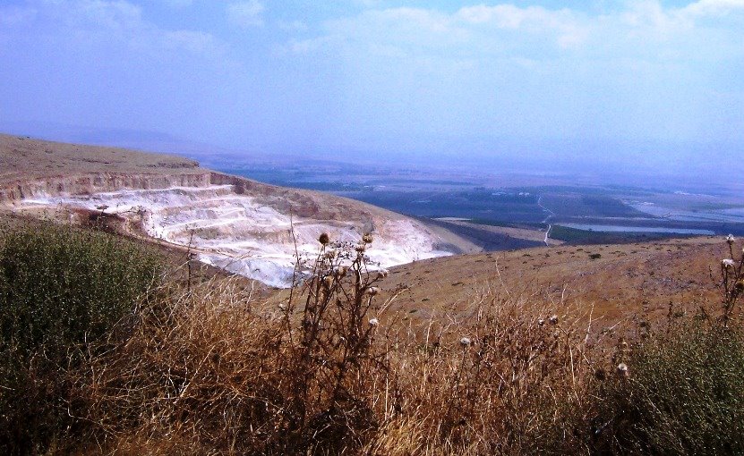
The modern one was built by Israel probably in the 60s or 70s to go to Oron, south of Dimona, where Israel has phosphate mines. We actually saw a freight train on its way to Oron, as we drove by, and I shot the picture above.

We went to a restaurant in an open shopping mall for lunch, and the parking lot was super-full. Haim told us that some of the stores in this mall were open on Shabbat, which surprised me. When we left an hour later after lunch, more than two-thirds of the cars had disappeared. For many people, Friday is the first day of the weekend, so they use it for shopping and for fun outings before Shabbat begins.

After lunch, we went back to sightseeing....this time to cemeteries.

First we stopped at the cemetery where British soldiers were buried. During World War I, the British decided to bury their soldiers where they fell instead of trying to bring them back to their country, so the British government established (and still maintains) a cemetery here in Beersheva. Most British cemeteries have a center area with a cross and an upsidedown sword but due to sensitivity to the Muslims at that time, there is no upsidedown sword. The British cemeteries at Mt Scopus in Jerusalem and Ramleh are different than here. The families were allowed to have anything that wanted written on the stones (which are all the same size). They could put the symbols from their units or a cross. In this cemetery, there is at least one grave with a magen david (Jewish star). If you look carefully at the pictures that follow, you can see what they had written at the bottom.


The British Embassy continues to maintain this cemetery. It is relatively small for such a cemetery, just about a block and a half by one block. Most of those buried here died between October and November of 1917. As you can see from above, modern (rather luxurious) condos have been built in the area of the cemeteries. Haim and his wife think that it is strange that people would want to live so close to the cemetery, but I mentioned that they might enjoy seeing the grass. Having grass in the cemetery is not normal practice in Israel as maintaining it is quite expensive because of the scarcity of water. (Haim says that the British government maintains many huge British cemeteries throughout Europe so this is not unusual.)


Christian soldier--on bottom: "Til we meet at the end of the trail...beloved."
Unknown soldier's grave...with cross-- on bottom "Known unto G-d"


Grave of Jewish soldier....you can see that there are stones on top of this grave, the only one we saw with stones on top--a Jewish sign of having visited.


Howard in front of Jewish soldier's grave so you can see the size of the graves.

Also on one side of the cemetery, there was a special marker which you can see below. During the war, a number of British pilots fell from planes or crashed and died. The body of one was found by the Turks and buried in this spot with a gravestone on it, marking the spot. Later the British replaced the Turkish monument with this new monument below with the names of a total of 8 pilots lost in this area during World War I. It says on it, "This monument generously erected to one of them by their enemies was discovered and restored by their friends. January, 1918." To me it seemed amazing that the Turks were so sensitive.


From this grassy British war cemetery, we went to the first Jewish cemetery in town, one that is still in use. As you can see from the pictures, there is no grass at this cemetery.
Newer part of the Jewish cemetery with some recent graves and more "modern" Beersheva in the background.

Unidentified grave of the 7 or 8 Jews who died in the train car in Beersheva during WWI when they didn't use blackout curtains--referred to above. The grave closest to front is that of a wife of one of the men whose grave was added years later.
A modern grave with a "window" in the back where there are 2 yarzeit (memorial) candles. Other graves also had such little nitches for these candles.


I cannot end this blog without a picture of a pretty flower...this one (a pelargonium often used in window boxes) was taken in the flower box on the entry to the restaurant where we had lunch. It was small, about 2 inches in diameter, but really pretty. You can see it in relations to the Henna's Chick just above it. There were more Henna's Chicks, which were all much larger than we used to have when I lived in Spokane, WA.